

WATCHER: 20% OF SDPD’S PROPOSED SURVEILLANCE CAMERAS ARE WITHIN OR BORDERING THE CITY’S HOMELESS ENCAMPMENT BAN ZONES
20% are proximal to public transit stops.

Recently, two moves by the city have received substantial media attention: the police department’s surveillance camera proposal, and the mayor’s homeless encampment ban. The former has yet to be approved by city council, although the privacy advisory board has recommended the council vote it down. The latter was approved in a split vote, and will likely go into effect on the 29th of this month.
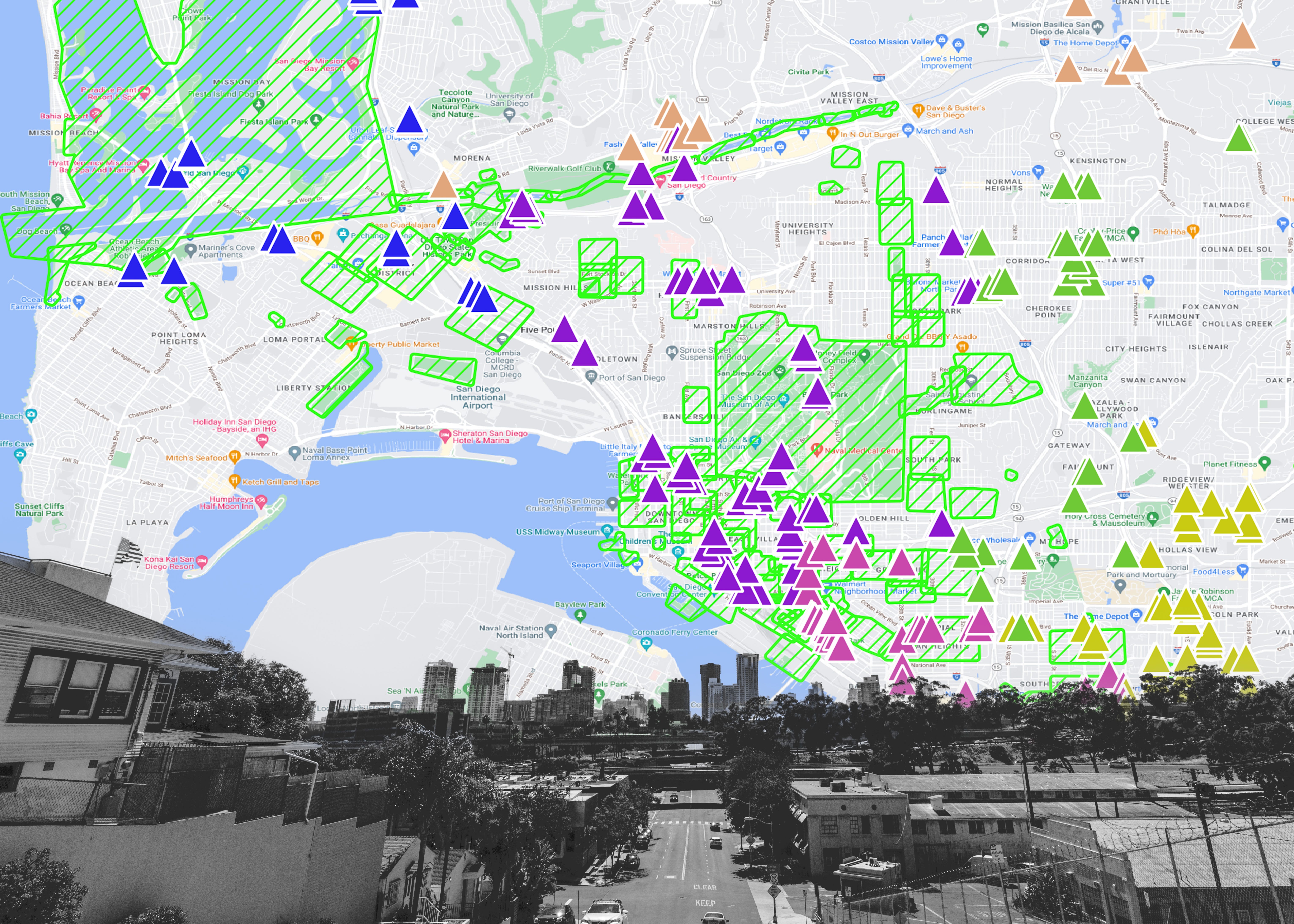
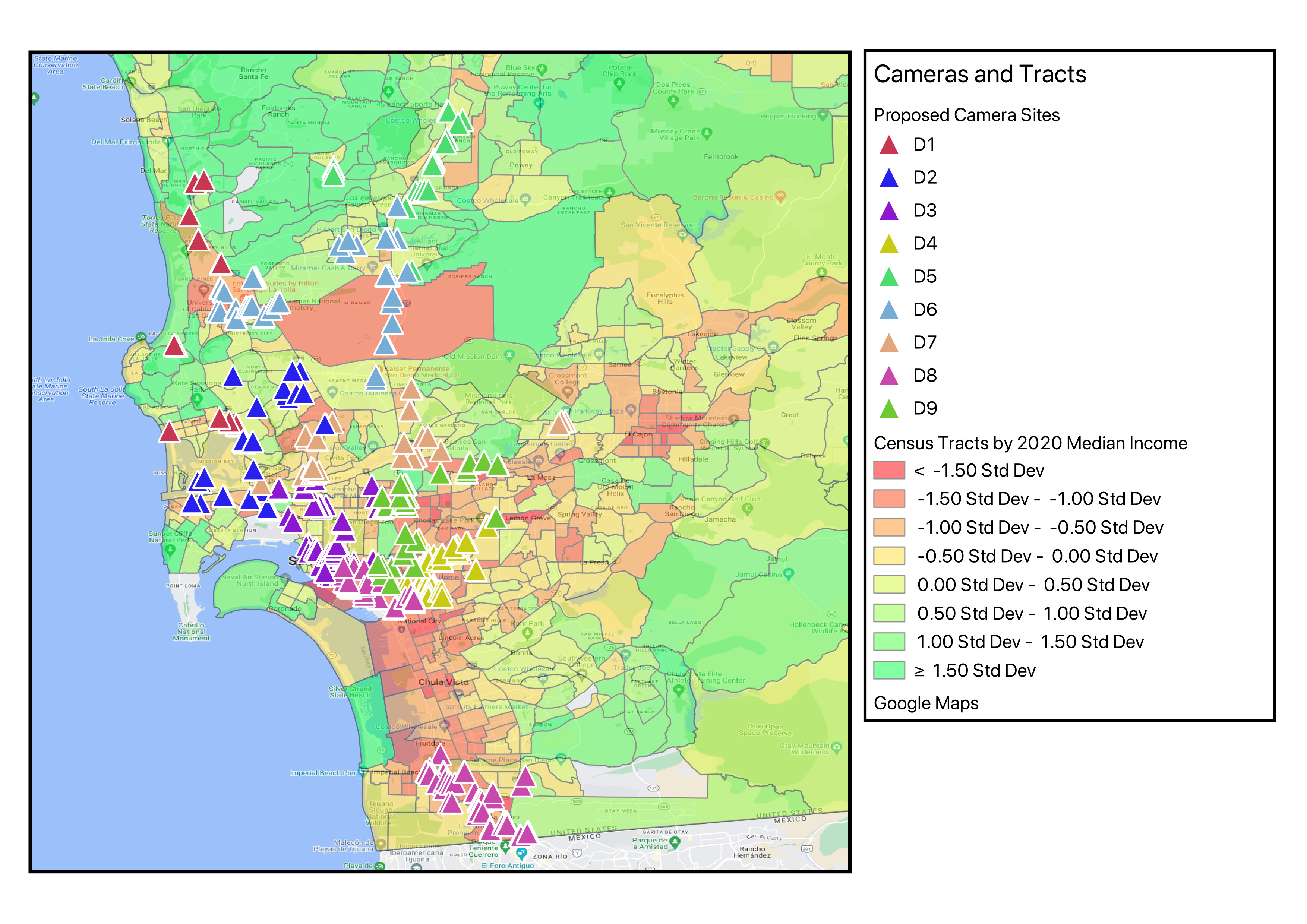
These policies both impact San Diego’s most marginalized people. As such, I was curious as to how these policies might interact. I’ve imported Voice of San Diego’s map of the encampment ban zones and manually entered SDPD’s proposed camera sites into a GIS tool. Since crime and poverty are strongly correlated, there is significant overlap between SDPD’s proposed surveillance sites and the city’s ban areas.
For context, San Diego’s city blocks are generally 200 by 300 feet.

Near Chicano Park, several public transit stops have proposed camera sites within their 125-foot buffer. Most are bordering the street. 102 of the proposed cameras are within 125 feet of a public transit stop.

106 cameras are directly inside or within 150 feet of encampment ban zones. One of those cameras is slated for the intersection of 20th and B, the intersection outside the city’s newest safe camping site.
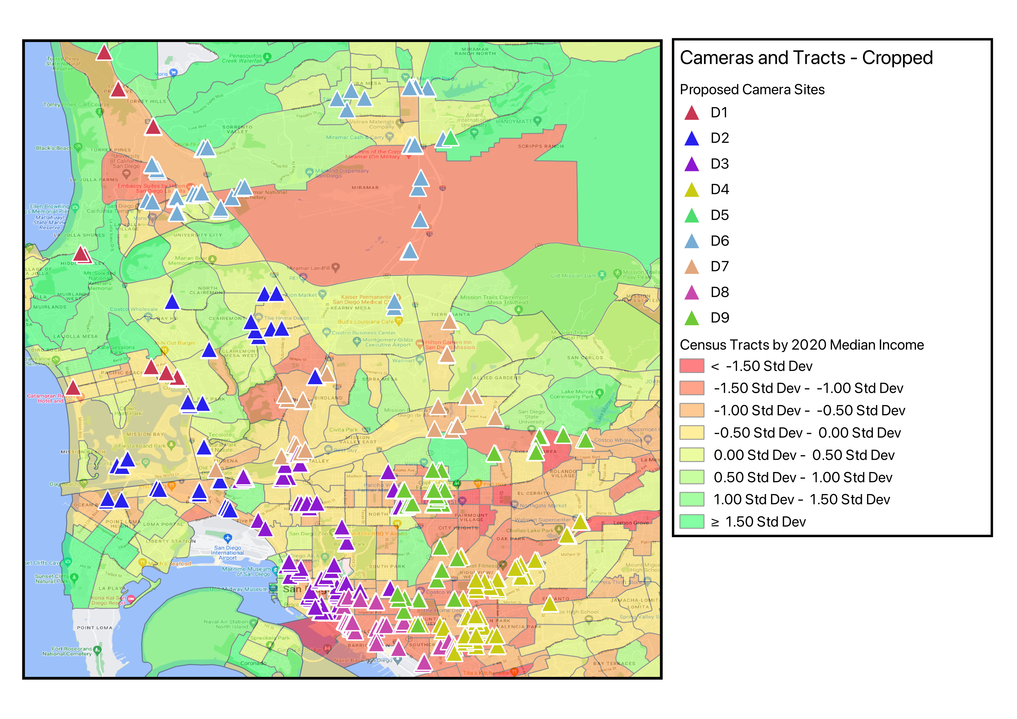
When looking at the distribution of cameras over census tracts by median income, the disparities are more apparent. The highest income areas generally do not have proposed camera sites, and there are dense areas of cameras in census tracts with median incomes that are 1 to 1.5 standard deviations below the mean.

Seven cameras are within 0.5 miles of an abortion provider. This impacts four abortion providers, with one notable exception. An abortion provider in district six has one camera in its buffer, 310 yards to the north (less than 0.2 miles). But, there is a camera to the provider’s east, west, and south just outside that buffer.

The proximity of cameras to these facilities is troubling given the Sacramento Sheriff’s Department sharing ALPR data with states where abortion is illegal, and SDPD’s past compliance issues with privacy laws.

Seven cameras are within 200 feet of a homeless shelter. This impacts four shelters. One Alpha Project shelter has three cameras within that buffer, at the intersection of 17th and. That intersection is also at the doorstep of Villa Harvey Mandel, an apartment complex for formerly unhoused people.


I visited some of the sites where cameras are proposed—in particular, areas where cameras are clustered densely in groups of three or more. I was struck by how many of these sites bordered residences.
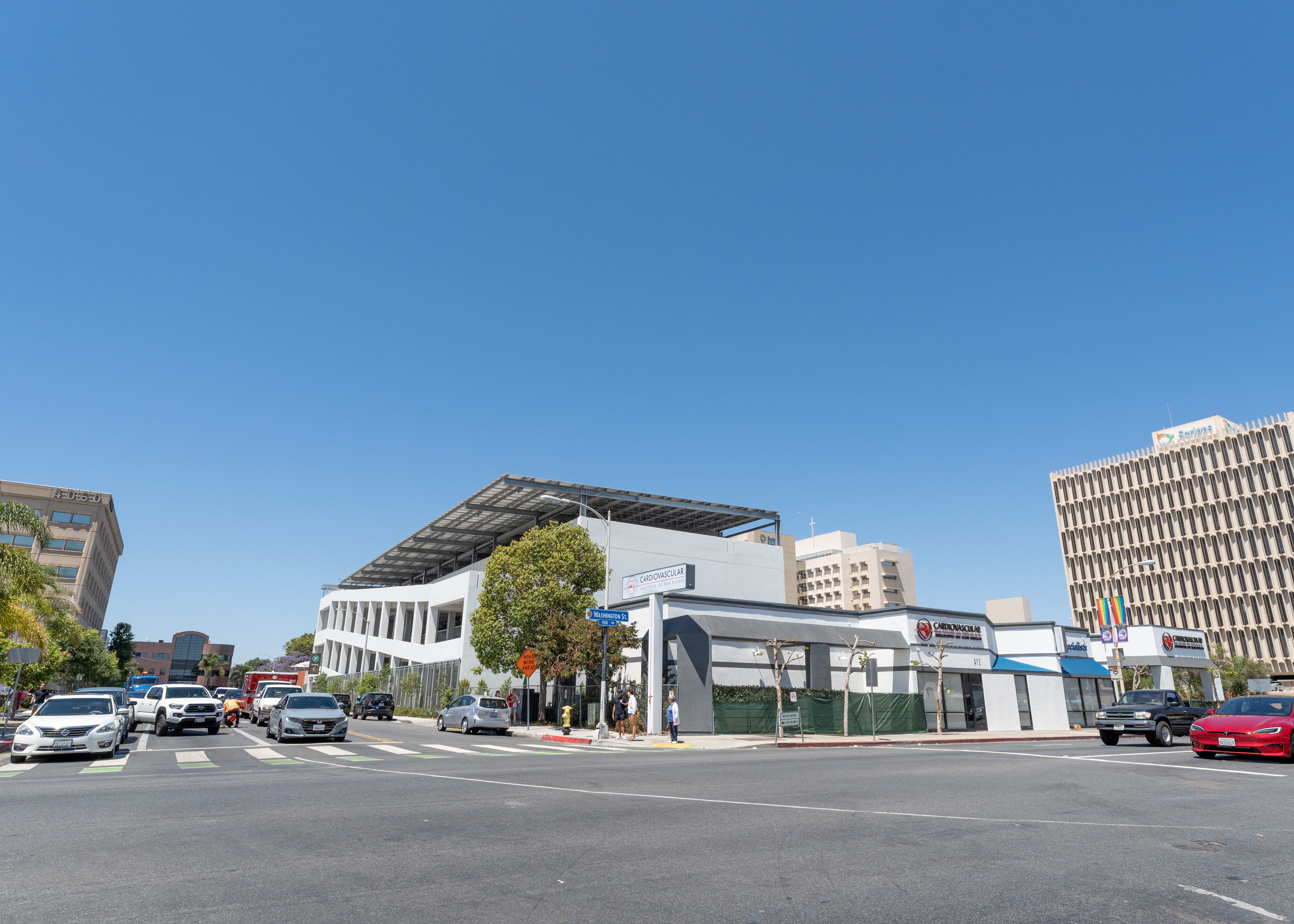
Some sites feel bizarrely redundant. For example, Washington and 4th in Hillcrest is the proposed site for three cameras. But, the CVS at this intersection has its own private camera tower in the parking lot. Across the intersection, the cardiovascular clinic has signs posted indicating the premises are recorded by its own security cameras. The Shell gas station presumably has its own cameras as well.
A fifth of these cameras fall within the encampment ban zones. A fifth fall within 125 feet of public transit stops. If the $4 million pre-allocated by the mayor for the camera proposal is an accurate figure, $800,000 would be going to the cameras placed in the encampment ban zones he signed into law.
The GIS file I’m working from can be downloaded here. I’m still working out a better solution for online access, but for now I’ve moved some of this data into a Google Map.

I encourage you to browse this map and see if any cameras are near your address, and if places you frequent experience a combination of increased cameras, low median income, and homeless encampment ban zones.